What daily life feels like
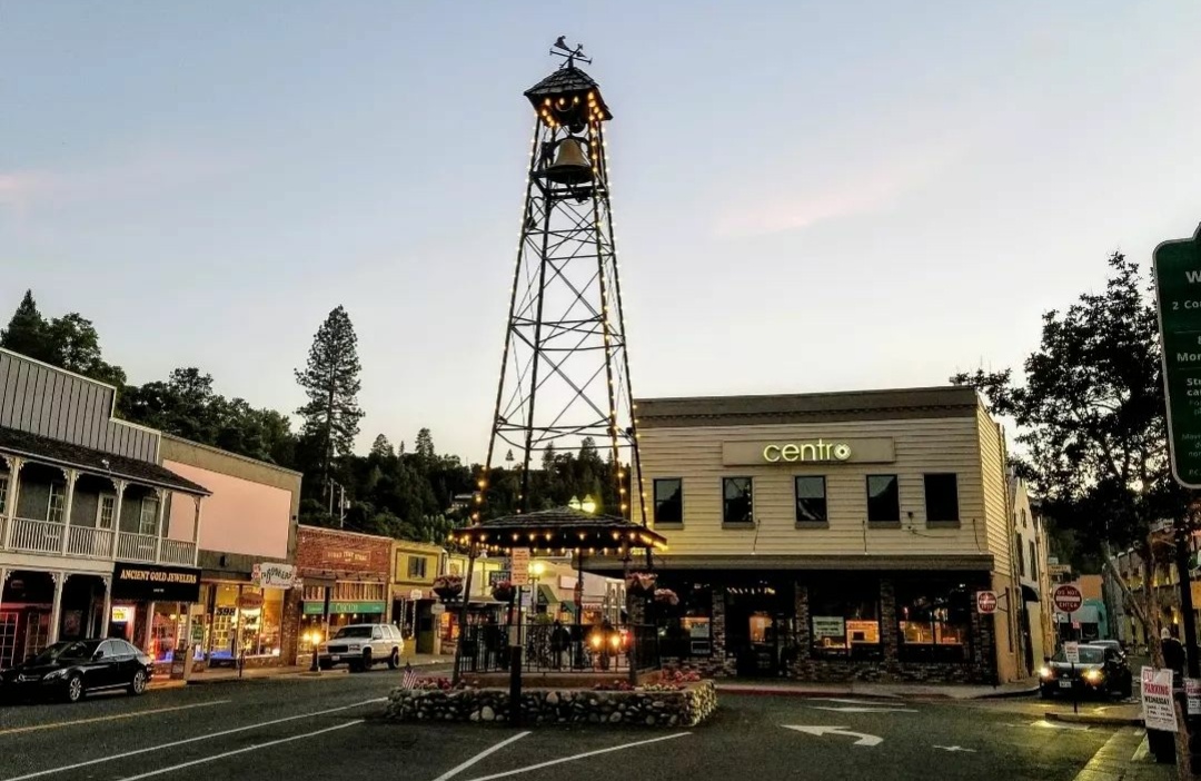
Placerville is the county seat of El Dorado County and a Gold Rush town that never turned itself into a theme park. Main Street is a working street: the Bell Tower stands over it, and the blocks around it hold coffee shops, restaurants, hardware and feed stores, and businesses that have been serving ranch families for generations. Locals run into each other. Errands come with conversations.
The town sits in oak covered foothills at just under 2,000 feet, high enough to be out of the Sacramento Valley fog on most winter mornings and low enough that snow is an event a few times a year rather than a season. The regular snow country starts higher up Highway 50, around Pollock Pines. Ten minutes east of town, the orchards and farms of Camino, known across Northern California as Apple Hill, turn fall weekends into a local institution.
Life here runs at two speeds. In town, it is small and walkable. A few minutes out any road, it is acreage, animals, wells, and quiet.
The homes and the land
In town you will find older homes on established streets: Craftsman and Victorian era houses near the historic core, mid century homes on the hillsides above Main Street, and newer subdivisions on the town edges. Lots range from compact in-town parcels to an acre or more as streets climb.
Outside the city limits, Placerville is ranch country. Properties run from a couple of acres to twenty or more, with oak woodland, pasture, barns, arenas, and room for trailers and equipment. Many have been in the same family for decades, which means improvements range from meticulous to improvised, and the paperwork matters. Most acreage properties run on well water and septic systems. Many older in-town homes do too, so the question is worth asking on every property here, not just the rural ones.
Getting around
Highway 50 runs straight through town and is the spine of daily life. Westbound, it reaches Folsom in about half an hour in light traffic and Sacramento in roughly forty five minutes to an hour, depending on the hour. Eastbound, it climbs through Camino and Pollock Pines toward South Lake Tahoe, about an hour and a half away. Highway 49 heads north to Coloma, where gold was first found in California, and on toward Auburn, and south toward the Amador County wine country. There is no rail service. Placerville is a driving town.
Questions buyers ask me
Will my home be on a well and septic system?
Outside the city limits, almost always. Inside town it depends on the property, and many older in-town homes are on septic. A well flow test and a septic inspection are standard parts of buying acreage here, and I will tell you which records to ask the seller for before we write anything.
Does it snow in Placerville?
Some winters, a few times, and it usually melts within a day. The dependable snow line sits higher, up the hill. If a property's elevation matters to you, we will check the specific parcel, because a few hundred feet of elevation changes the answer on the roads above town.
How far is Apple Hill?
Minutes. The Apple Hill growing area surrounds Camino, the next community east on Highway 50. In the fall it draws visitors from across the region, and locals learn which back roads to use on October weekends.
What is the Gold Hill area?
An unincorporated ranch area west of Placerville along Gold Hill Road: rolling pasture, oak trees, and properties with room for horses and equipment. It is some of the most practical acreage close to town, and it is where a good share of my ranch work happens.
Thinking about Placerville?
I live and work here, and I am glad to talk through a specific property or a general plan. Call me at 916.524.3535.